Manihiki Island Airport (Manihiki Island Airport)
Manihiki Island Airport is a public airport on the atoll of Manihiki in the Cook Islands. The airport was built in the early 1980s, but not used for commercial flights until 1991. Originally it had no terminal, with passengers checking in under the overhang of a nearby house and waiting in the open or in the shade of nearby trees. In 2018 construction began on a purpose-built terminal.
| IATA Code | MHX | ICAO Code | NCMH | FAA Code | |
|---|---|---|---|---|---|
| Telephone | Fax | ||||
| Home page |
Map - Manihiki Island Airport (Manihiki Island Airport)
Map
Country - Cook_Islands
 |
 |
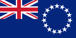
| Flag of the Cook Islands | |
Since 2001, the Cook Islands has run its own foreign and defence policy. In recent decades, the Cook Islands have adopted an increasingly assertive foreign policy, and a Cook Islander, Henry Puna, currently serves as Secretary General of the Pacific Islands Forum. Most Cook Islanders are citizens of New Zealand, but they also have the status of Cook Islands nationals, which is not given to other New Zealand citizens. The Cook Islands have been an active member of the Pacific Community since 1980.
Currency / Language
| ISO | Currency | Symbol | Significant figures |
|---|---|---|---|
| NZD | New Zealand dollar | $ | 2 |
| ISO | Language |
|---|---|
| EN | English language |


